




SPACE October 2026 (No. 707)
Sixty years ago, the 1966 Seoul Master Plan, the first comprehensive urban master plan for metropolitan Seoul, was established. With 1985 as its target year and an optimal population of five million envisioned, the plan proposed a decentralisation model for the rapidly growing population. It outlines a road network extending toward the outskirts, ring roads, and Seoul’s first subway line, providing a blueprint for the urban structure.
In August of the same year, the ‘8·15 Urban Planning Exhibition’ was held in the plaza in front of Seoul City Hall to commemorate the 21st anniversary of Korea’s liberation. The exhibition became a remarkable public event, inviting nearly 800,000 visitors, equivalent to one-quarter of Seoul’s population at the time.
This August, ‘The Making of Seoul’s Urban Future’ opened in the special exhibition gallery of Seoul Museum of History. The archival exhibition traces the processes through which Seoul has taken shape, from the city’s first urban master plan established in 1966 to the present, while examining both its achievements and limitations. The exhibition brings together 344 archival materials, including early drawings from the urban plans developed six decades ago and confidential documents from the Urban Planning Bureau.
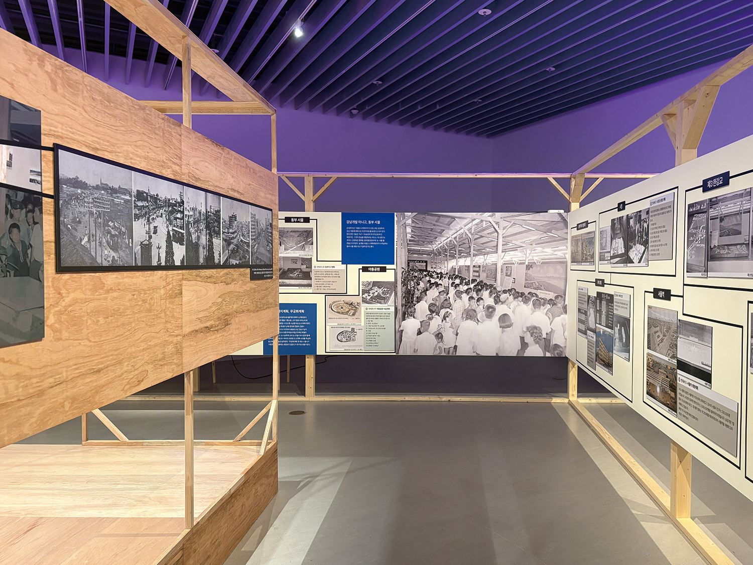
Exhibition view recreating the ‘8·15 Urban Planning Exhibition’. ©Kim Jeyeon
Curated around two main elements, the 1966 Seoul Master Plan and the ‘8·15 Urban Planning Exhibition’, the exhibition has been organised into four different sections to trace 60 years of urban planning in Seoul. First, it begins by introducing the historical background, from postwar reconstruction in the 1950s to the enactment of Urban Planning Act and the establishment of Urban Planning Bureau in the early 1960s. The exhibition then presents materials produced by the Urban Planning Bureau throughout the 1960s and 1970s. Ranging from large hand-drawn maps for land surveys and property management to records on street networks, parks, and rivers, as well as studies of foreign cities, these materials are displayed as if in a reading room. Although these sources may appear limited from today’s perspective, they are the evidence of the intensive investigation of people who lived during that time. Moving beyond the archive, the exhibition introduces the structure and content of 1966 Seoul Master Plan. Major components of the plan, including the development of Gangnam and the designation of industrial zones along the Hangang River, laid the foundations for Seoul’s present-day urban structure. Other proposals, such as a polycentric urban structure organised around the Hangang River, were never realised, but remain significant as points of reference in imagining the spatial organisation.
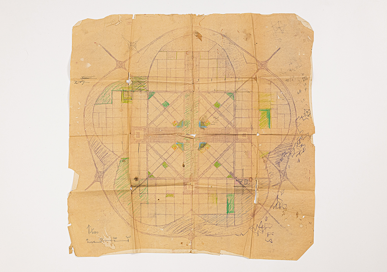
Original copy of the New Seoul Blank Plan (1966). Image courtesy of Seoul Museum of History
Adjacent to this section is a scaled reconstruction of the ‘8·15 Urban Planning Exhibition’. Overall exhibition space, including its layout and structure, was recreated through research into photographs, film footage, exhibition guides, and other materials from the period. This signature exhibit reveals the conditions of Seoul in the 1960s, various development projects, and models of the future city allow visitors to imagine the landscape that people encountered more than half a century ago. Another noteworthy exhibit is the original piece of New Seoul Plan (1966) by Park Byungjoo. Although this ideal city plan, conceived in the form of a mugunghwa, was never realised and was often be criticised as ‘delusional,’ some elements of its ideas were later applied to new-town planning outside of Seoul. It therefore remains significant as an early experiment in modern urban planning in Korea.
The final section briefly traces the trajectory of Seoul’s urban planning after 1966. Through the original reports, it examines the evolution of the city’s nine urban master plans, culminating in the 2040 Seoul Urban Master Plan (2023), while also introducing recent analysis and research methodologies. The exhibition concludes with a portrait of Seoul today highlighting keywords identified through the 2024 monitoring and assessment of the Seoul Urban Master Plan. Recalling the exhibition at the time, urban planner Sohn Jeong Mok wrote, ‘Residents from the outskirts who visited the exhibition climbed ladders to take a close look at the road network’. In other words, the crowds came to find out whether a road would be built through their own neighbourhoods. The tendency to understand the city in relation to the value of one’s private property does not seems that different today. However, a city must also remain a shared ground for collective life. Moving back and forth between individual desires and public values, it continues forward, however unsteadily. The exhibition runs until Nov. 8.
